The interstate cut through the middle of his great-grandpa's farm, by where BT&D is. On forty acres, the government seized fourteen. Darrick asked for documentation; Jared has none and said he would check with Aunt Pat.
— Jared Niese
Community history
A 1962 aerial, fourteen acres of one family's farm, and the four-way stop that used to be there.
Photos
The story so far
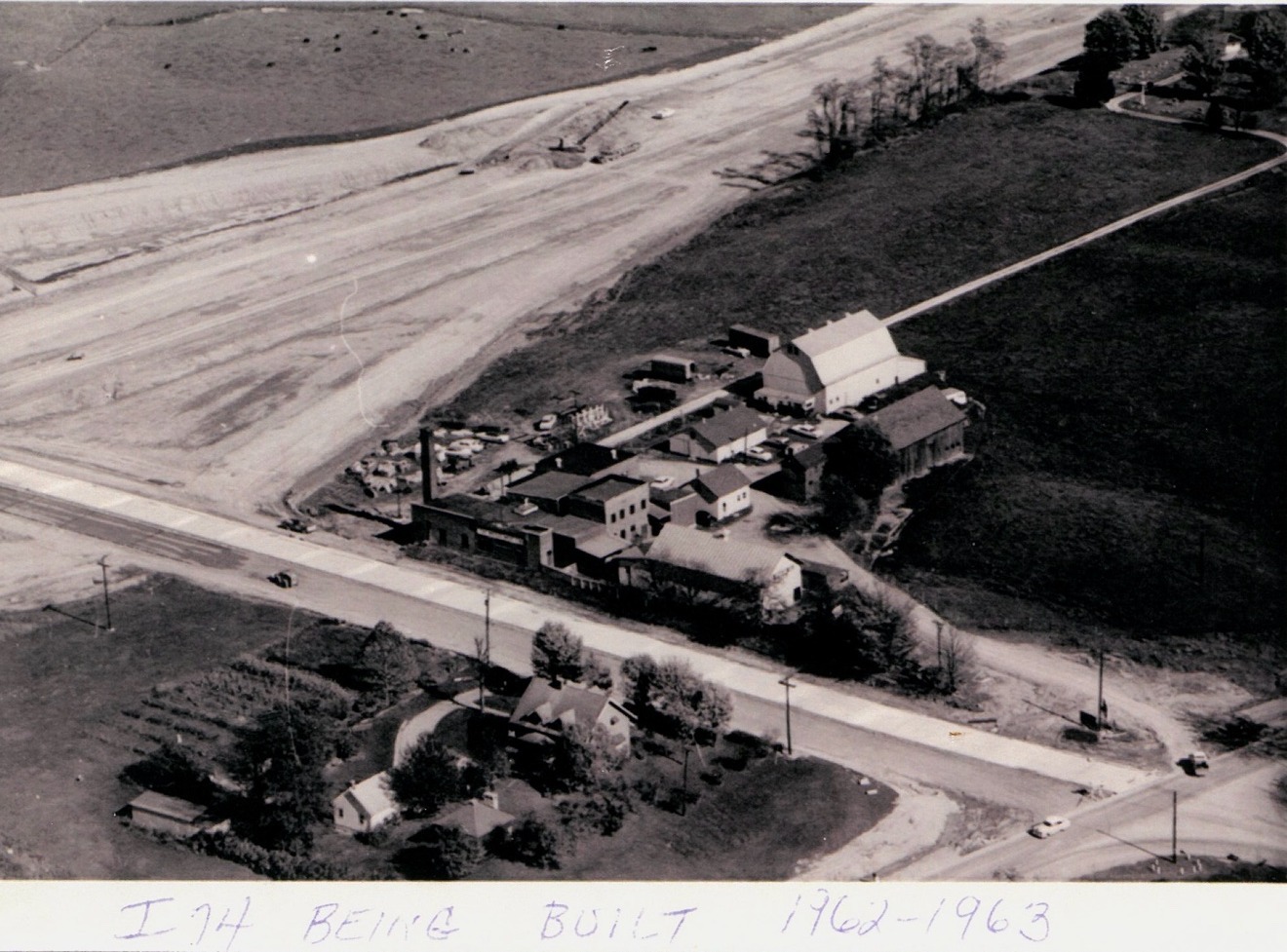
The photo is an aerial from 1962–63, handwritten 'BUILT 1962–1963' along the bottom: a cleared corridor cutting diagonally across farmland, earth-moving equipment on the graded roadway, and below it a cluster of farm buildings — a white barn, outbuildings, a house — beside the old two-lane road.
The interstate did not pass through empty ground. It cut through the middle of one family's farm by where BT&D is today — fourteen of forty acres, taken by the government. The farm is where the BP station is now. Neighbors in the comments are still sorting out which side it sits on, and whether the family was paid or moved by eminent domain.
Timeline
I-74 built through Batesville.
The crossing in the photo was a four-way stop.
The government takes 14 of 40 acres of the Niese family's farm by where BT&D is.
What neighbors remember
The interstate cut through the middle of his great-grandpa's farm, by where BT&D is. On forty acres, the government seized fourteen. Darrick asked for documentation; Jared has none and said he would check with Aunt Pat.
— Jared Niese
That's sad — it used to be a four-way stop.
— Greg Fullenkamp
The meat-processing plant in the frame became Hellmich Standard — his dad told him so; the plant's earlier name is forgotten now. (That settles Robert Linville's guess of Benz's Meat Market.)
— Stephen Macke
The house on the near side of the photo was a Hunteman house. It stood until the CVS was built.
— Sam Wintz
Remembers an old slaughterhouse out by the I-74 Cincinnati entrance ramp — a huge wooden warehouse for livestock.
— Marc Young
Still to learn
See also
Share a memory, a photo, or a correction — or answer one of the open questions above. Submissions are reviewed by a person before anything appears publicly, and nothing is posted as-is. Photos are used only with your permission and with credit as you give it.
Last updated November 13, 2026. New memories appear here after review.